The Postman’s Trail - Faroe Islands
A more leisurely start to the day again on the third and final full day in the Faroe Islands - we’d had a look into the weather forecast for the day and aimed to try and catch some of the nicer weather towards the end of the day for part of our hike.
Trail Conditions: A little slippy in places with Loose gravel on the path down.
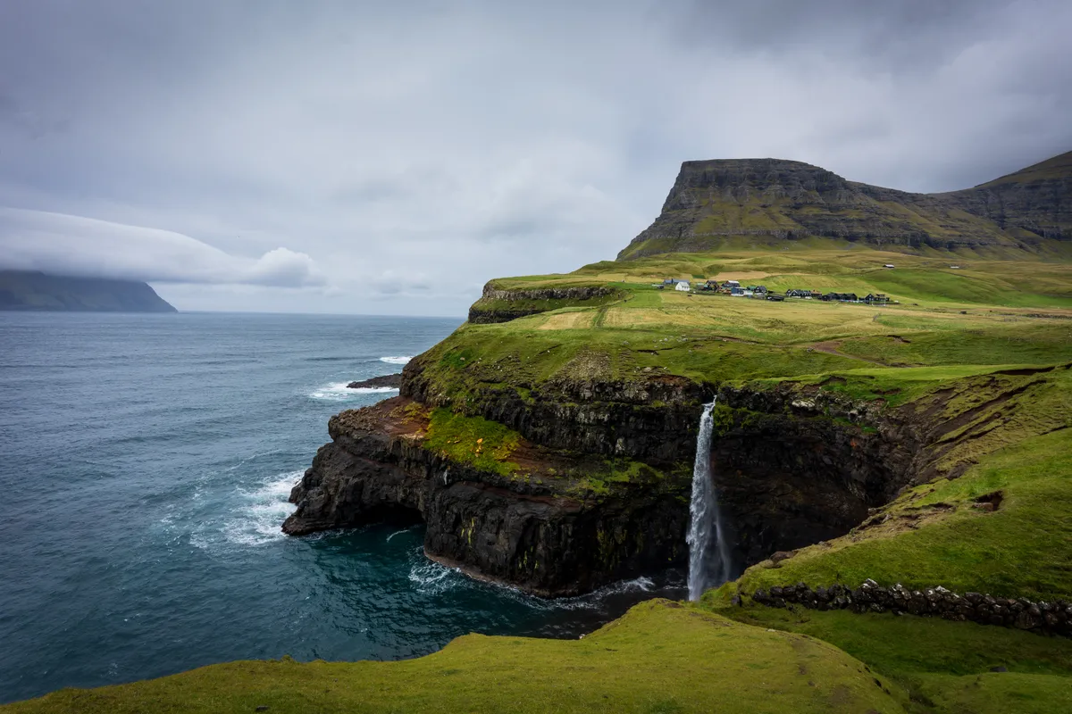
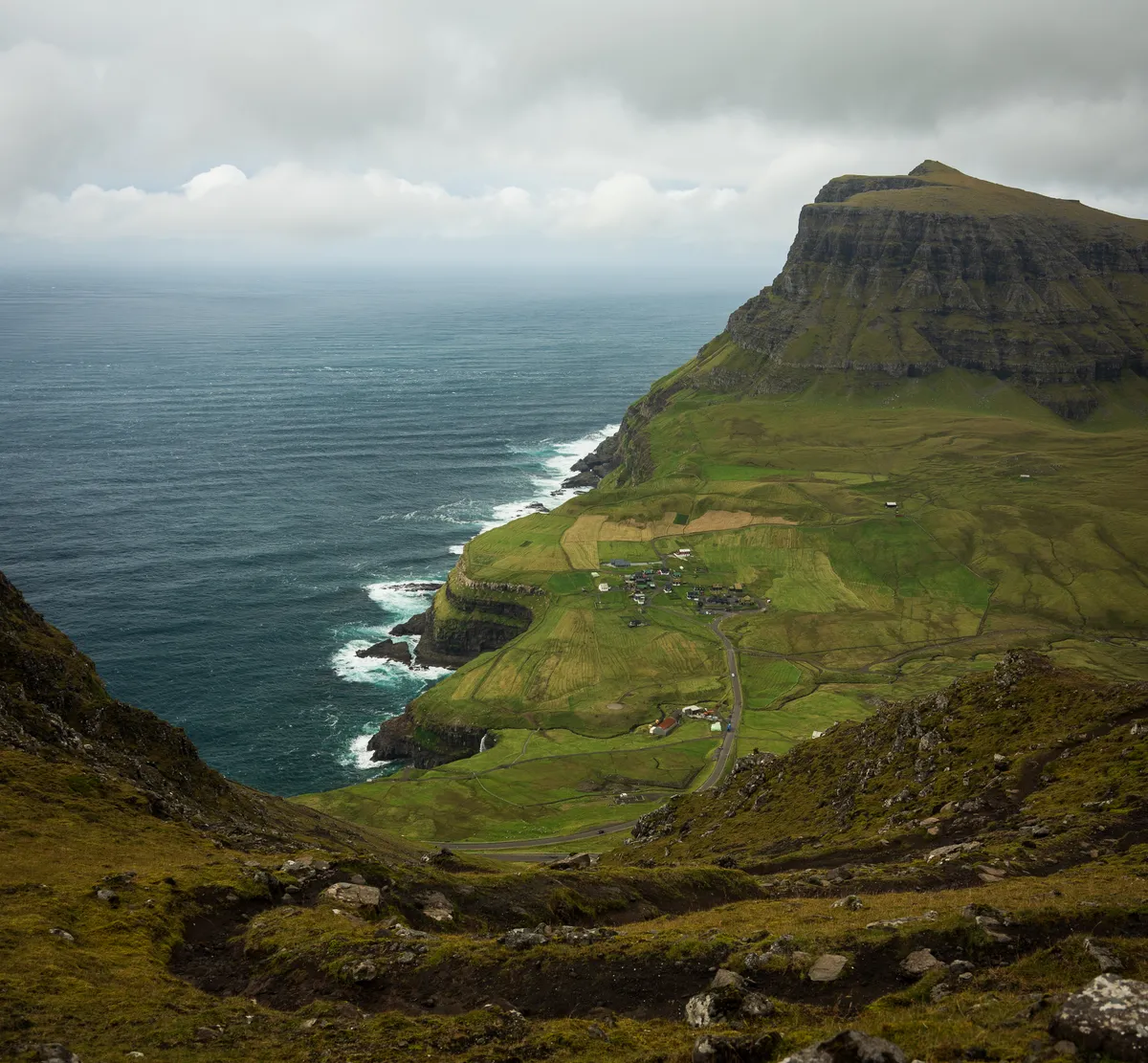
Today’s goal was to complete the Postman’s Trail, which is marked as one of the top 100 hikes in the world. This was on the opposite side to the hike we’d done the previous day to Dranganrir although it is not the full original postman’s trail unfortunately.
A more leisurely start to the day again on the third and final full day in the Faroe Islands - we’d had a look into the weather forecast for the day and aimed to try and catch some of the nicer weather towards the end of the day for part of our hike.
Today’s goal was to complete the Postman’s Trail, which is marked as one of the top 100 hikes in the world. This was on the opposite side to the hike we’d done the previous day to Dranganrir although it is not the full original postman’s trail unfortunately.
Our guide told us that one of the local postmen had done the trail one morning and then returned in the afternoon only to find a massive landslide had claimed parts of the path and fallen away into the sea below.
So this trail has some options with how you tackle it, you can either park up your car near the gravel road that leads to the start of the trail, hike over the trail and take some photos of the incredible looking waterfall that the valley is famous for, and then retrace your steps back over the mountain and back down to the car.
Alternatively, you can do the trail one way and then attempt to hitchhike your way back through the tunnel to the trail head.
We set off at around half 11 and started making our way up the mountain towards the summit. There had been a substantial amount of rain dumped on the islands the night before and the paths were slick in places which meant careful footing was required.
There was also an incredibly strong, gusty wind forcing us to really pay attention to our balance and also refrain from going too close to the edge where the original trail had sheared off the side of the mountain.
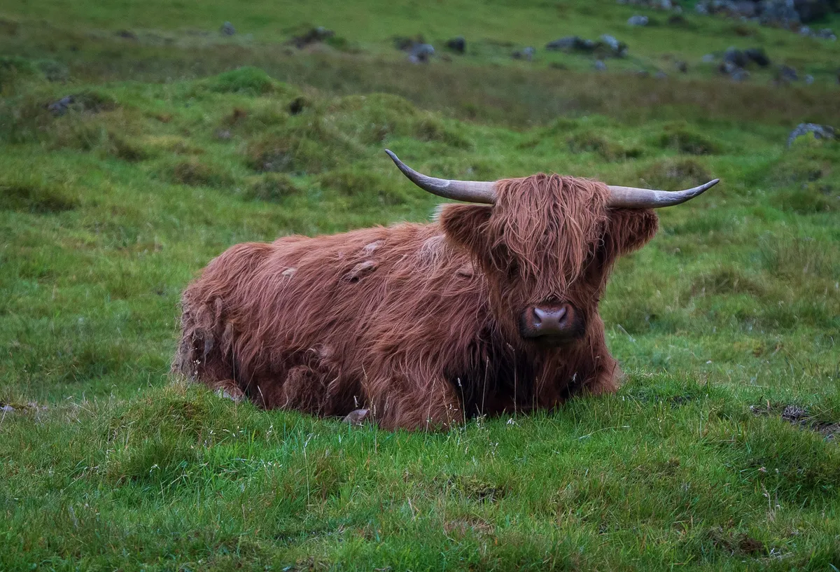
A few slips here and there, and a few sheep annoyed that they’d had to move off the foot path, but an otherwise uneventful climb to the top of the trail. Brazenly we then decided to attempt topping the near by summit and made it quite far in our climb before having to call it due to the incredibly powerful gusts of wind punishing us in our overly exposed location on the hill.
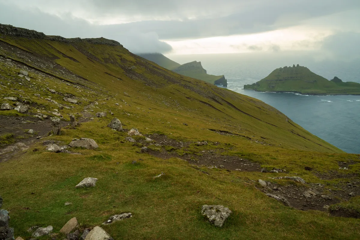
At this point, we headed back down to rejoin the path and continue onwards to the next valley over. Eventually, you come to the cairn marking the start of the descent and you get incredible views down into the valley below.
This is also where the path starts to get a little more treacherous as we were about to find out…
The combination of heavy rain and loose scree trails made for a more challenging descent and there was a point where Donna lost her footing and landed heavily on her tailbone and hitting her knee quite hard as she started to try to self arrest the fall.
I swear my heart jumped out of my chest seeing her almost take what could have been an incredibly serious tumble down the hill. Thankfully, she escaped with a bit of lower back pain and a significant bruise on her knee which we’re hoping both heal up fairly quickly.
We continued on down the path, continuously twisting down what we’d coined as the “slippy-zaggys” before coming to the road and heading on to the path which lead to the viewpoint for the waterfall.
The scene itself is just fantastic. The high winds meant that we were watching the waterfall continuously reverse it’s flow back into the valley which was incredibly dramatic. I’d recommend bringing some wider lenses so that you can attempt to capture the drama of the waves crashing against the rocks below, the waterfall, and the incredible backdrop with the town and the high peak behind it.
After spending a bit of time trying our best to do this scene justice, we headed back up the road and started heading back to the car for some well deserved snacks and a can of Jolly (Local Cola).